Got something to say or just want fewer pesky ads? Join us... 😊

[Misc] The Award-winning official "More Snow Tomorrow?" Thread [2023-24 Season]


Papa Lazarou

Living in a De Zerbi wonderland
Jul 7, 2003
18,951
Worthing
thats we we employ you Papa!!, to give us the information, those charts yesterday "suggested" constant snow for most of Friday into Saturday, it appears thats changing slightly if you look at ther wording above, but as you say they have to protect themselves somewhere, lets hope we do get some of the white stuff, ebnuoght o at least make a snow man and post the picture on here, this threads deserves it!!

I'd hate to think how many pages, and actual days it's been since we've had photos of decent snow in Sussex on here... Dec 2010?


Flex Your Head

Well-known member
I have questions!

What is the forecast for slightly further ahead, say, a week today? Is it likely to remain cold or will we have a return to murky, damp, grey days with 8 degrees?

How come, even though it was bitterly cold overnight, there seems to be very little frost this morning? The car windscreen was icy, but only a very fine sheen.

Please can someone explain what the dewpoint is in layman’s terms?

Cheers :eek:)


Papa Lazarou

Living in a De Zerbi wonderland
Jul 7, 2003
18,951
Worthing
Papa,

The wife is going to Brussels this morning and coming back (Eurostar) on Friday about 6 p.m, is there likely to be disruptive snow around then please.

Cheers


Didn't we do this the other day?

anyway - Brussels is now looking dry, sunny and blooming cold - perhaps cloudy on Friday.

It's this end that's the problem... The latest forecasts suggest the snow will be close to London (if not already there) by the time she returns (on the assumption she's going from London). It will certainly be snowing down here by then, so getting home might be tricky.

Cheers Papa,

The other day I asked about going out this morning not coming back, she's delayed anyway now going out because of the Helicopter crash and looks like she'll be delayed coming back due to snow.

She will not be a happy bunny.


Papa Lazarou

Living in a De Zerbi wonderland
Jul 7, 2003
18,951
Worthing
I have questions!

What is the forecast for slightly further ahead, say, a week today? Is it likely to remain cold or will we have a return to murky, damp, grey days with 8 degrees?

How come, even though it was bitterly cold overnight, there seems to be very little frost this morning? The car windscreen was icy, but only a very fine sheen.

Please can someone explain what the dewpoint is in layman’s terms?

Cheers :eek:)

1. next week is very uncertain - it really depends on how well the block holds, and how the low 'exits' the UK - the Worthing ensemble shows a large spread of possible temps.

Meteociel - Diagrammes GEFS

2. The level of frost will depends on the air temperature, humidity of the air, wind speed and dew point. If the dew point (see below) is very low, then it can still be not cold enough to condense the moisture out of the air, despite temps of -2C, as it was in Durrington this morning. Also, a breeze can stop frost from being deposited, as it stops the lower layer of air (in contact with the cooling ground) from cooling as effectively.

3. Dew Point - is simply a measure of temperature at the moisture within a given body of air will condense into liquid water. This is related to the dryness of the airmass, so drier air has a lower dew point.

If you look at the current Dew Points here

http://www.weatheronline.co.uk/cgi-bin/expertcharts?LANG=en&MENU=0000000000&CONT=ukuk&MODELL=gfs&MODELLTYP=1&BASE=00&VAR=taup&HH=0&ZOOM=0&ARCHIV=0&RES=0&WMO=&PERIOD=

You can see that with the colder / drier air coming in from the East, the Dew Points are low at the moment, so in many places it won't have been cold enough for a hard frost. Some places will have reached that level, and freezing fog would form in these areas (as it has around Gatwick this morning).

The Dew point is key to getting snow, even more than surface temp. As long as the Dew point is below zero you can get snow at above freezing.


Frutos

.
Helpful Moderator
NSC Patron
May 3, 2006
35,728
Northumberland
Re: The award-winning official "More snow tomorrow?" thread [2012-13 season]

I'm flying to New York on January 28th...if the weather cocks that up I shall be SERIOUSLY pissed off.


Djmiles

Barndoor Holroyd
Dec 1, 2005
12,062
Kitchener, Canada
A shift to the east with the precipitation in the latest run. Still 12 hours of snow predicted by the latest models. As always, still time for change but this could be it....

Edit: If this pans out, 90% of games will be off this weekend.


Flex Your Head

Well-known member
1. next week is very uncertain - it really depends on how well the block holds, and how the low 'exits' the UK - the Worthing ensemble shows a large spread of possible temps.

Meteociel - Diagrammes GEFS

2. The level of frost will depends on the air temperature, humidity of the air, wind speed and dew point. If the dew point (see below) is very low, then it can still be not cold enough to condense the moisture out of the air, despite temps of -2C, as it was in Durrington this morning. Also, a breeze can stop frost from being deposited, as it stops the lower layer of air (in contact with the cooling ground) from cooling as effectively.

3. Dew Point - is simply a measure of temperature at the moisture within a given body of air will condense into liquid water. This is related to the dryness of the airmass, so drier air has a lower dew point.

If you look at the current Dew Points here

http://www.weatheronline.co.uk/cgi-bin/expertcharts?LANG=en&MENU=0000000000&CONT=ukuk&MODELL=gfs&MODELLTYP=1&BASE=00&VAR=taup&HH=0&ZOOM=0&ARCHIV=0&RES=0&WMO=&PERIOD=

You can see that with the colder / drier air coming in from the East, the Dew Points are low at the moment, so in many places it won't have been cold enough for a hard frost. Some places will have reached that level, and freezing fog would form in these areas (as it has around Gatwick this morning).

The Dew point is key to getting snow, even more than surface temp. As long as the Dew point is below zero you can get snow at above freezing.

Excellent, thanks very much. I'm still not entirely sure I understand dewpoint, but I'm definitely getting there.


Giraffe

VERY part time moderator
Helpful Moderator
NSC Patron
Aug 8, 2005
26,689
I'd hate to think how many pages, and actual days it's been since we've had photos of decent snow in Sussex on here... Dec 2010?

Scarily so. Very frustrating. I fear for Worthing again this time.


n1 gull

Well-known member
Jul 25, 2003
4,638
Hurstpierpoint
`If Metcheck is right, Hurstpierpoint is in for bundles of snow at the weekend - please let it happen


Papa Lazarou

Living in a De Zerbi wonderland
Jul 7, 2003
18,951
Worthing
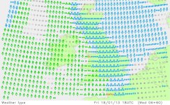
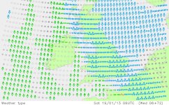
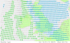
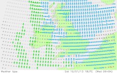
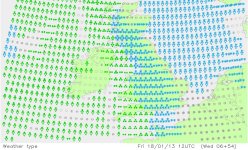
Just for fun

This is based upon the 6Z GFS - thought I'd capture these for posterity :)

It starts - Noon Friday
1 - Friday Noon.JPG

It continues and intensifies by 6pm Friday
2 - Friday 6pm.JPG

By Midnight it's heavy for us all
3 - Sat Midnight.JPG

6am Saturday shows it less intense for some, but still continuing
4 - Sat 6am.JPG

Noon Saturday - no let up really
5 - Sat Noon.JPG


Papa Lazarou

Living in a De Zerbi wonderland
Jul 7, 2003
18,951
Worthing
and finally the last chart

Saturday 6pm - an end is in sight.
6 - Sat 6pm.JPG


Djmiles

Barndoor Holroyd
Dec 1, 2005
12,062
Kitchener, Canada


SeagullSongs

And it's all gone quiet..
Oct 10, 2011
6,937
Southampton
Excellent, thanks very much. I'm still not entirely sure I understand dewpoint, but I'm definitely getting there.

I'll try and give you a simple explanation:

The amount of water vapour that can be mixed with air (saturation point) varies with the temperature of the air.
If the temperature of the air falls (to below the dew point) the air will no longer be able to hold on to all of the water, so it will be forced to condense on any nearby surfaces, causing dew. If the dew point is higher than the current temperature then there is currently dew. If the temperature is below 0 degrees Celsius this turns into frost.
Note: The dew point can be below zero degrees, so a morning with a temperature of below 0 does not guarantee frost, it depends on the humidity too.

Hope this helps!


Urchin

New member
Aug 1, 2011
820
The award-winning official "More snow tomorrow?" thread [2012-13 season]

What are the chances of Saturdays game being called off?


mrjon1976

Found bliss in ignorance
Jul 25, 2011
311
gravesend
Was considering going on Saturday, but given the latest set of forecasts then I am guessing that if they are accurate, it will be postponed....


Djmiles

Barndoor Holroyd
Dec 1, 2005
12,062
Kitchener, Canada


Albion and Premier League latest from Sky Sports


Top
Link Here